Various samples of my cartographic work.
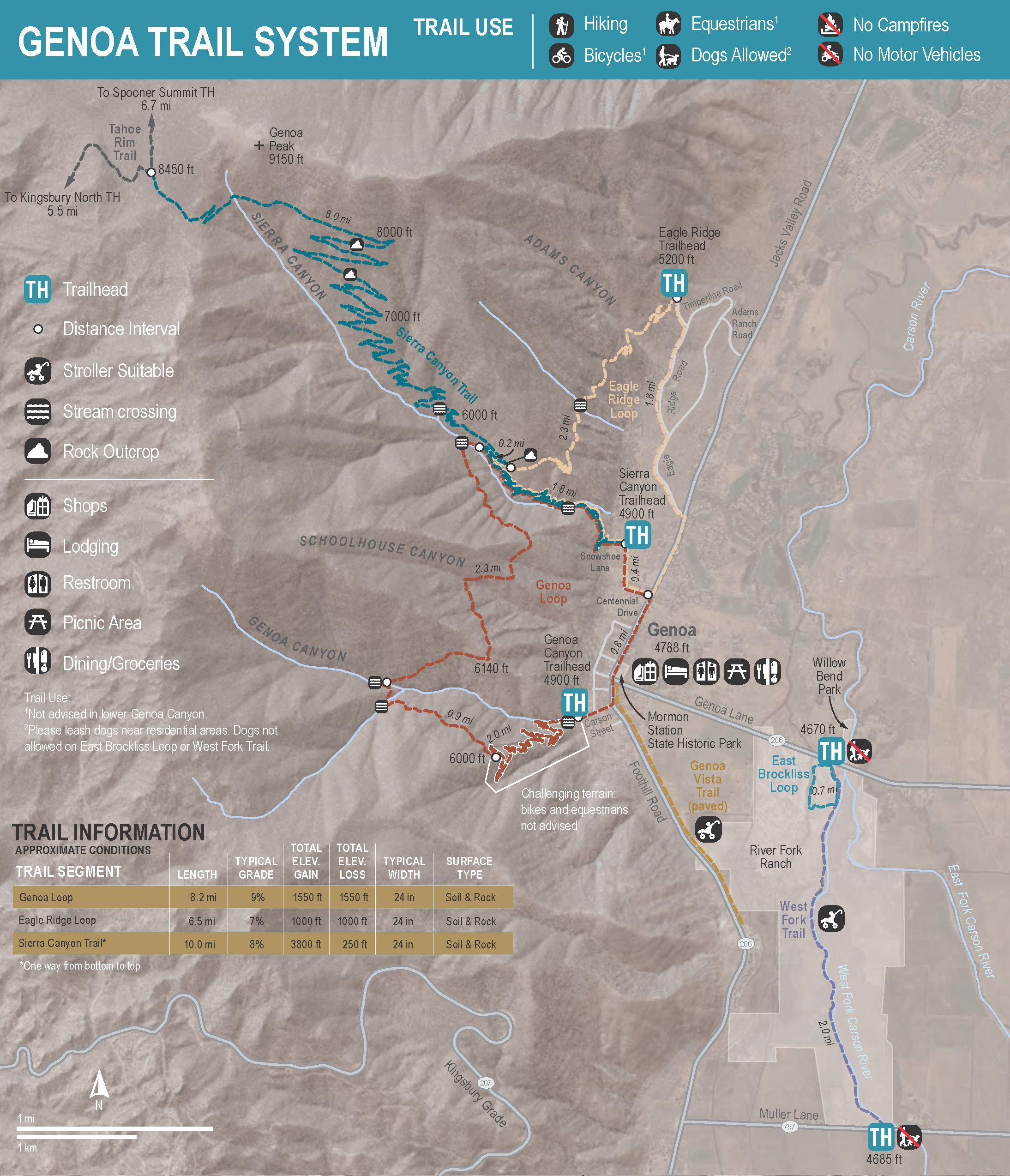

Trails of the Carson Valley
Trail maps designed for the Carson Valley Trails Association maps brochure. Brochure consists of six total maps, with five maps of individual trail systems and one overview map showing all trail systems built and managed by the Association.
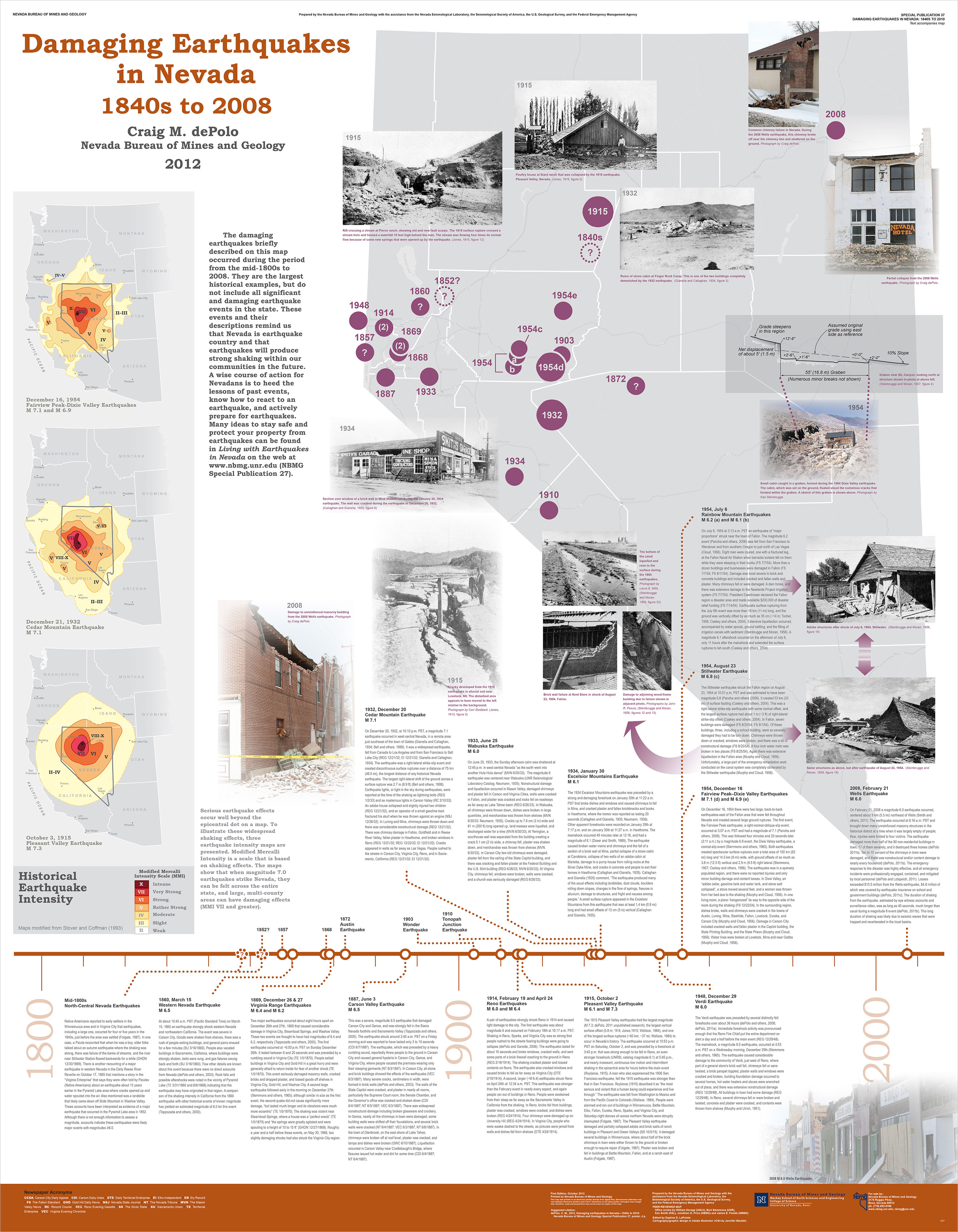


Earthquake Hazards in Nevada
Wall maps published by the Nevada Bureau of Mines and Geology showing active faults, seismicity, and damaging earthquakes in Nevada.

Tectonic Strain
Wall map published by the Nevada Bureau of Mines and Geology showing distribution of tectonic strain across the western US. Map was also selected for publication in the ESRI Map Book, volume 28 and received 1st place Cartographic award in 2012 from the Nevada Geographic Information Society.


Page-size maps
A variety of page-size and smaller maps created for presentations and publications.


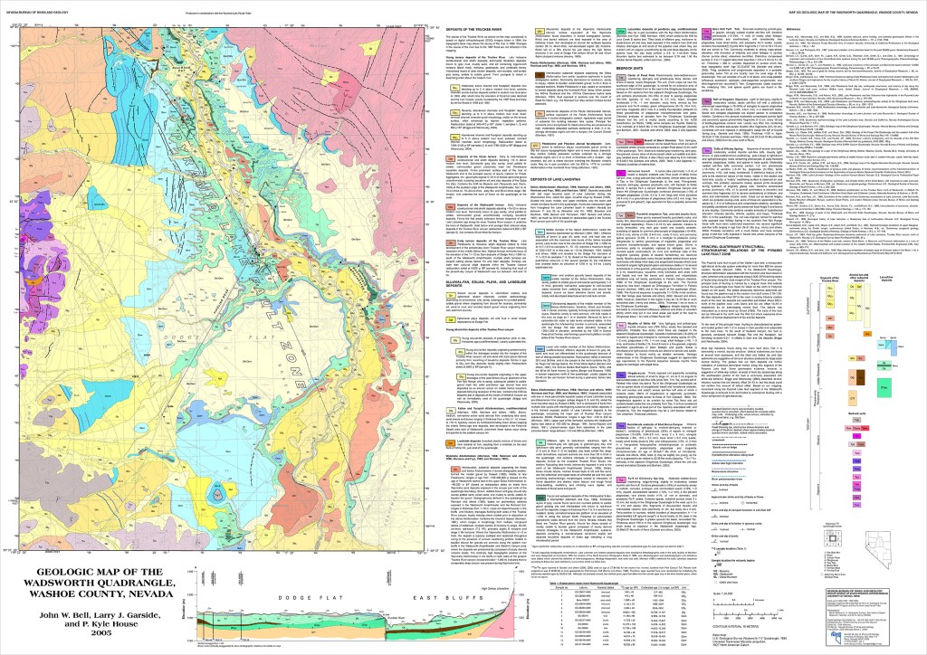
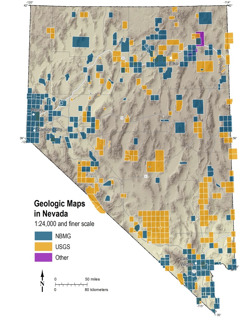
Geologic maps
My cartographic work on a small selection of geologic maps published by the Nevada Bureau of Mines and Geology.

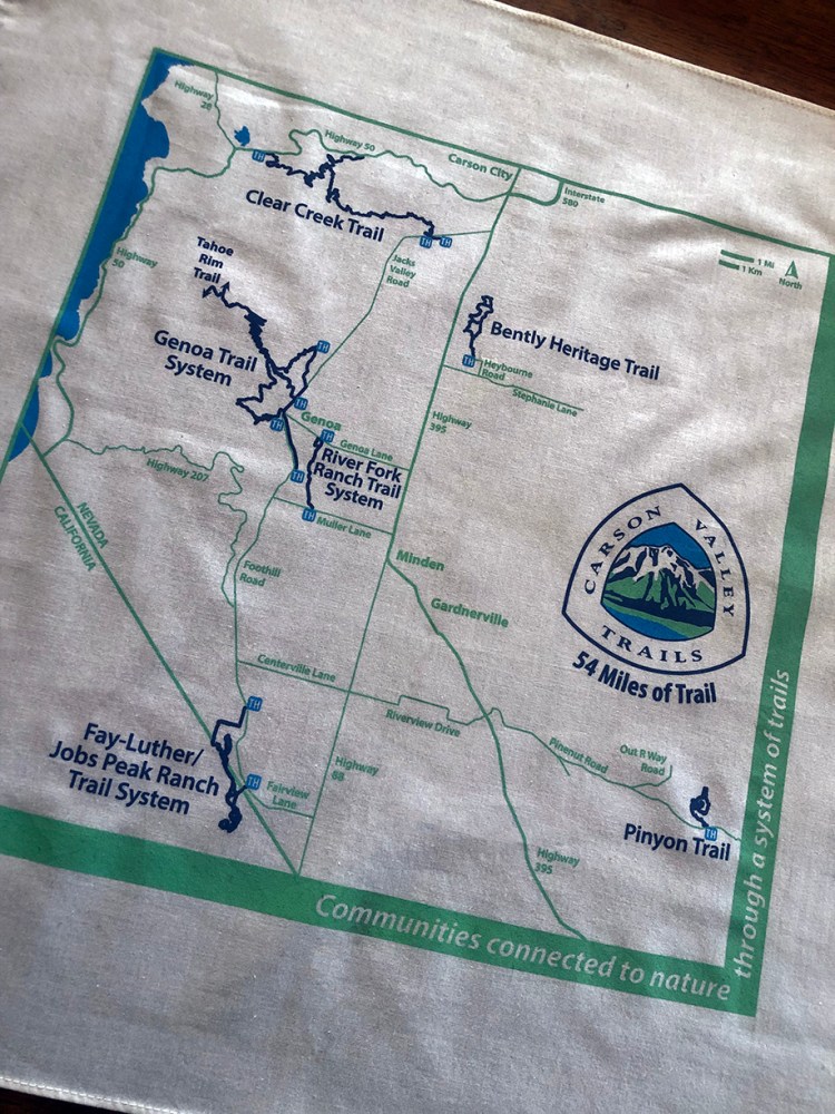
Wearable Maps
Simplified overview trail map produced for the Carson Valley Trails Association. Printed on cloth bandanas.
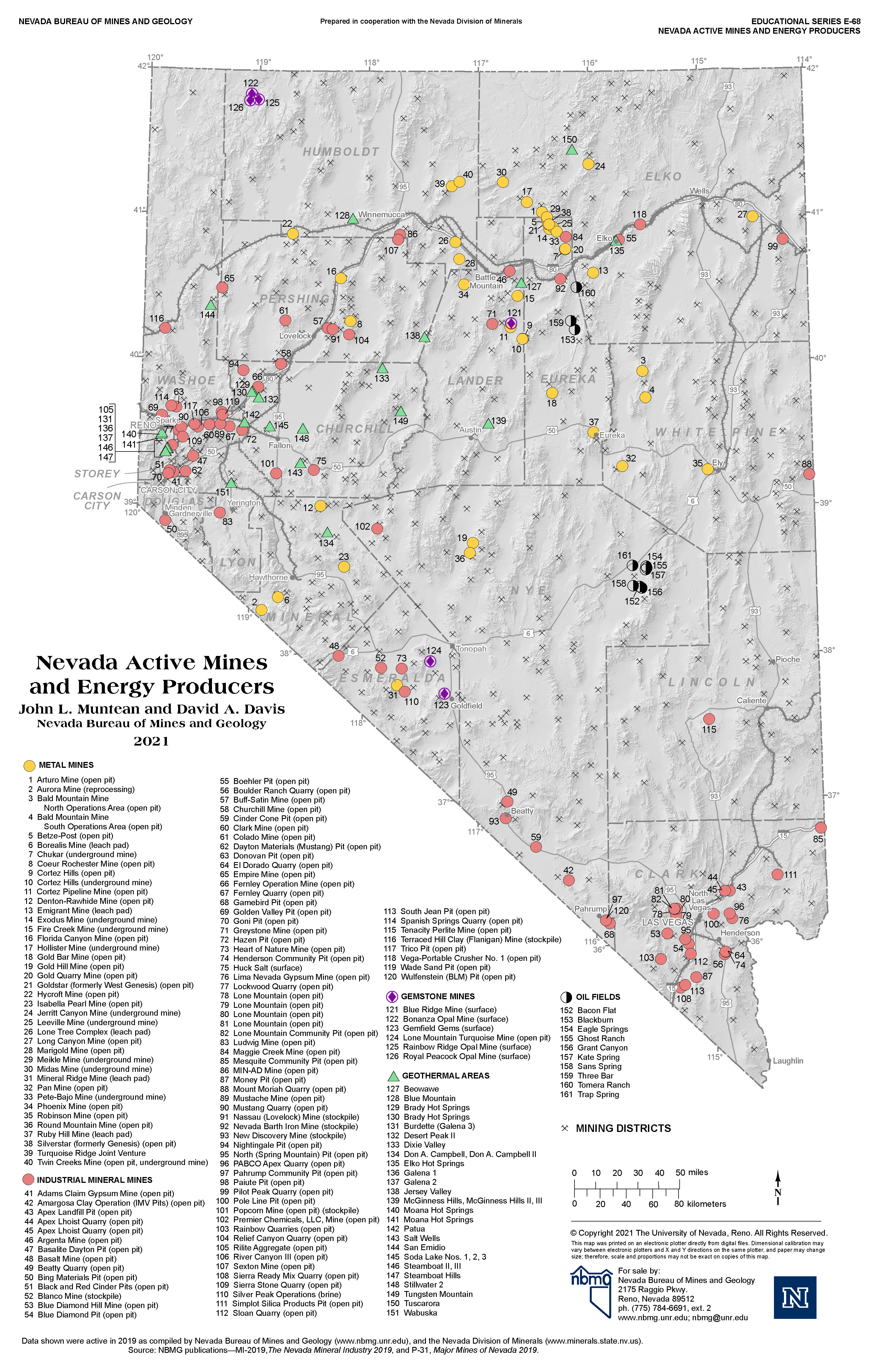
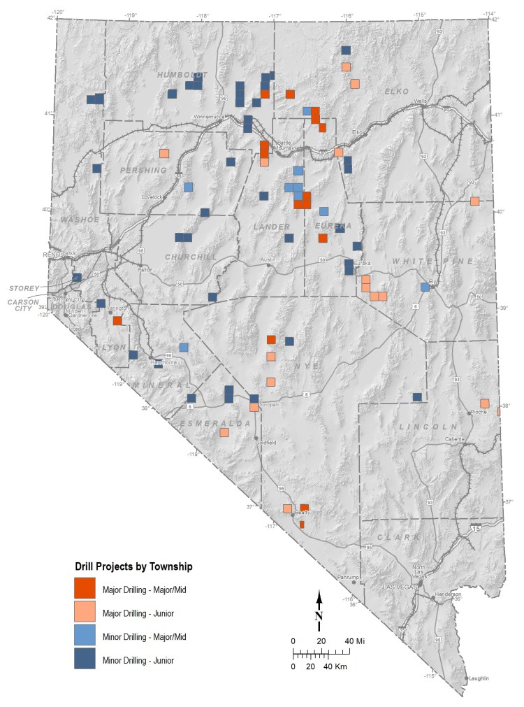
Nevada Active Mines and Energy Producers
Map published biennially by the Nevada Bureau of Mines and Geology showing mines, geothermal plants, and oil fields. Two versions of the map typically produced including an 11″x17″ map for educational purposes and a full-size, large-format version with more detailed information.

The Great 1906 San Francisco Earthquake
Map included in a 2006 research poster published by the Nevada Bureau of Mines and Geology about the effects east of the Sierra Nevada from the 1906 San Francisco earthquake. Map and poster were prepared for the 100-year anniversary of the earthquake.
